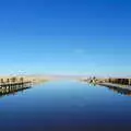
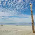
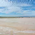
The serene slipway leading out to Salton Sea.
Part two of a grand tour of the desert of Southern California (well, 380 miles of it), goes from El Centro north up to the strange and deserted Salton City, by the edge of the Salton Sea. The sea, which has come and gone over thousands of years, is the largest lake in California and is 227 feet below sea-level. It was last filled by accident from a breach in the Colorado River around 1907, but has been drying out since, although opinions vary on whether the sea is dying a slow death or is a thriving oasis of sea-life. Whichever, after a bit of a searching, Nosher drove to the water's edge expecting it to be a bustling port with boats and stuff. Instead, the place is utterly deserted - silence hangs heavy in the air, interupted only occasionally by the cry of one of the pelicans nearby as it takes listlessly to flight. The sea is 25% saltier than the Pacific, and the smell is similarly more concentrated - dead fish litter the beach, which is made from countless millions of small shells. Nearby, a salt crust covers a small pool. Throughout the entire city, there's barely a sign of life - maybe that's just the season, as it was very hot - apart from another passing visitor who seems somewhat staggered to find a British tourist in the area. Even after chatting for a few minutes he thought I must be from Arizona. Leaving Salton, driving through the Anza-Borrega badlands, it was back to the town of Julian and the familiar drive down Route 79 to re-join the I-8. The Salton Sea remains, to-date, one of the weirdest, and yet most memorable places, ever visited.
next album: Scenes and People of Balboa Park, San Diego, California - 25th September 2005
previous album: California Desert: El Centro, Imperial Valley, California, US - 24th September 2005
The serene slipway leading out to Salton Sea.
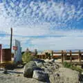
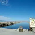
The top of the pier
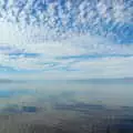
The surface conceals the reddish colour of the water
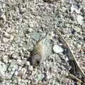
A dead Tilapia fish, which litter the shell beach
Some sort of navigation aid
A water-safety sign preaches to no-one
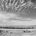
The pier in black and white
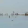
pelicans wait on stumps for passing fish
A salt crust
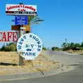
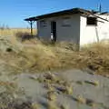
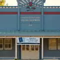
West Shores RV Park and Johnson's Landing café
Vanishing-point road, in the Carrizo Badlands
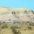
An example of gently-tilted sedimentary geology
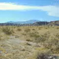
Some desert scrub
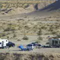
An RV camp out in the desert
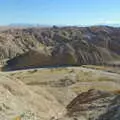
Moonscape in the badlands
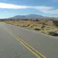
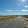
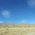
The desert road disappears off in to the mountains
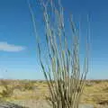
Desert foliage - an Ocotillo plant
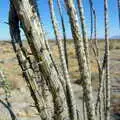
Close-up of prickly spines
Some nice clouds which look like dots on dice
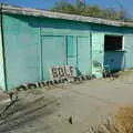
An abandoned golf shop in Borrego Springs
Another nearby derelict building
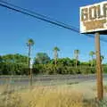
Old sign and palm trees on S22, Borrego Springs
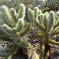
Cute fluffy-looking cacti near Julian, Route 78
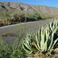
Aloe plants and mountains, Route 78
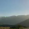
Rays of the setting sun picked out in the haze
Julian's post office
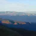
The mountains of Cuyamaca State Park
Hint: you can use the left and right cursor keys to navigate between albums, and between photos when in the photo viewer

The serene slipway leading out to Salton Sea.
The top of the pier
The surface conceals the reddish colour of the water
A dead Tilapia fish, which litter the shell beach
Some sort of navigation aid
A water-safety sign preaches to no-one
The pier in black and white
pelicans wait on stumps for passing fish
A salt crust
West Shores RV Park and Johnson's Landing café
Vanishing-point road, in the Carrizo Badlands
An example of gently-tilted sedimentary geology
Some desert scrub
An RV camp out in the desert
Moonscape in the badlands
The desert road disappears off in to the mountains
Desert foliage - an Ocotillo plant
Close-up of prickly spines
Some nice clouds which look like dots on dice
An abandoned golf shop in Borrego Springs
Another nearby derelict building
Old sign and palm trees on S22, Borrego Springs
Cute fluffy-looking cacti near Julian, Route 78
Aloe plants and mountains, Route 78
Rays of the setting sun picked out in the haze
Julian's post office
The mountains of Cuyamaca State Park